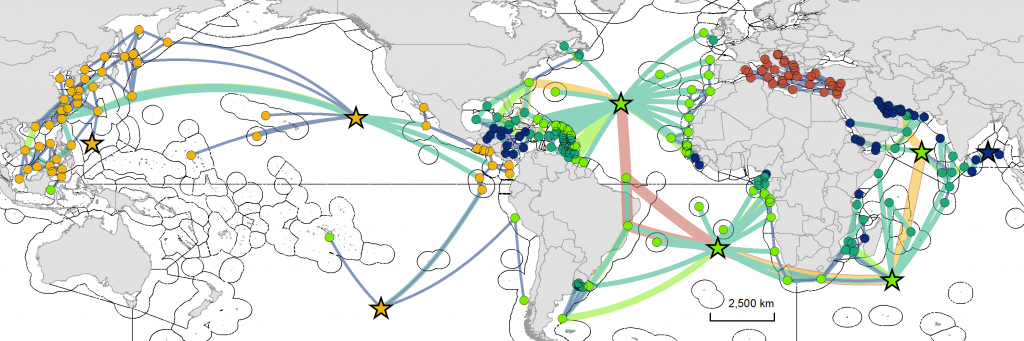
A recently published study – led by Duke University’s Marine Geospatial Ecology Lab (MGEL) with support from GOBI – used satellite tags on sea turtles to analyse complex movements across critical habitats. In total 1,235 sea turtles representing six species were tracked.
These highly migratory animals were tagged in 79 marine regions around the world, and the obtained data were “scaled up” within spatial networks. Spatial networks spanned across the Atlantic Ocean, Indian Ocean, Mediterranean Sea, and Pacific Ocean.
Analysing turtle movements in detail can help determine the importance or significance of individual areas used regularly by sea turtles, and of their connection to other areas, which can guide management efforts.
In the event of a change that disrupts the network, like a loss of habitat or the addition of a barrier that prevents access to habitat, the analysed tracking data could point towards knock-on effects on the turtle populations in other connected habitats.
Consequently, an area observed to be directly linked to a large number of other areas could be considered to have a high conservation priority, because it plays a central role in maintaining the survival of the whole sea turtle population.
Similarly, a unique linkage between areas within the network, a connection without alternative for animals to use, could also be identified as having a high conservation priority.
Furthermore, the network of linkages across multiple jurisdictions (such as national waters or areas managed by regional fisheries organisations) and spanning the high seas clearly demonstrates that efforts to maintain and conserve sea turtles and the connectivity across the ocean they depend upon, requires international collaboration.