Lead: Piers Dunstan, Commonwealth Scientific and Industrial Research Organisation (CSIRO)

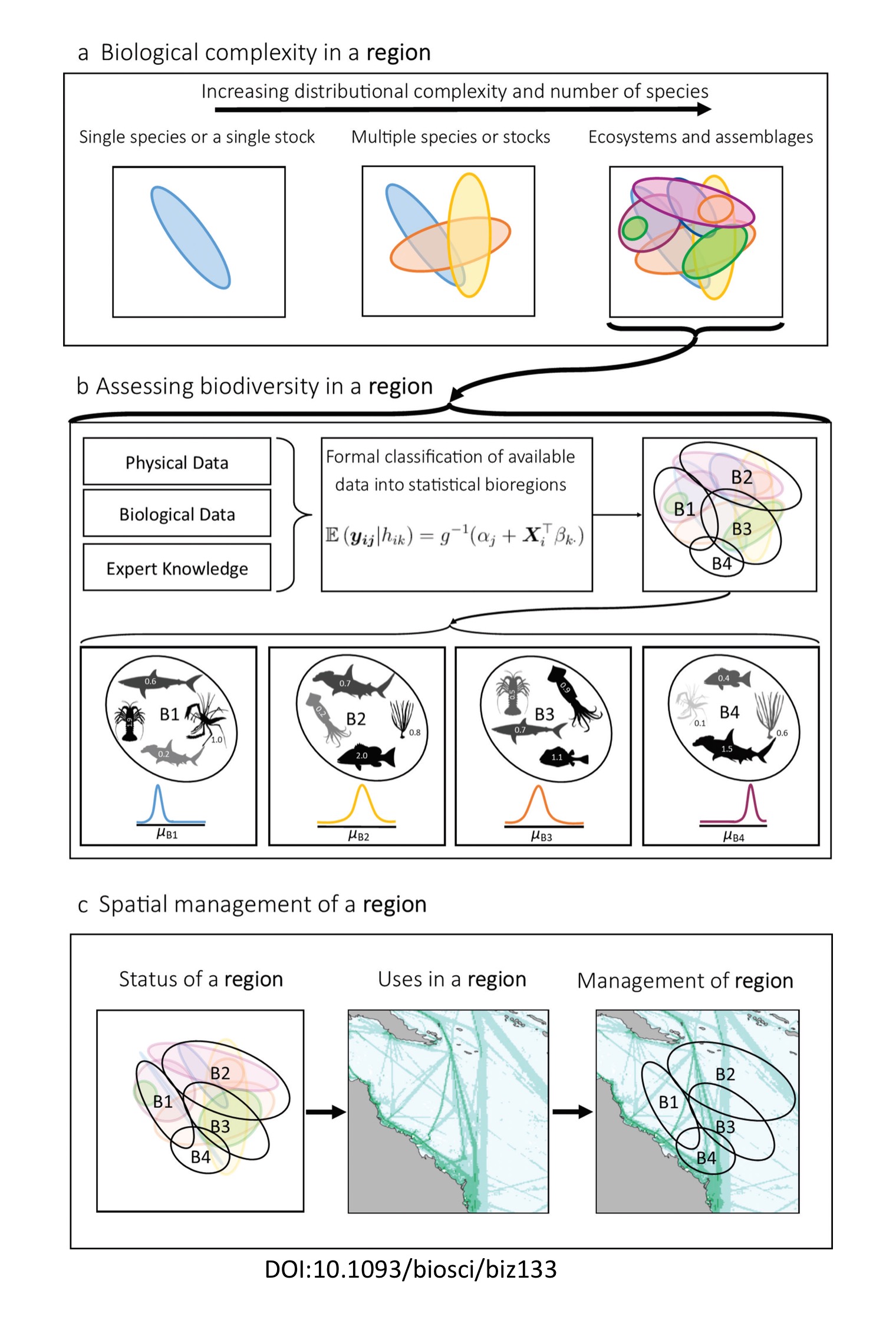
Biogeographic provinces are large regions that represent broad-scale biodiversity patterns that are relatively stable over space and time, and that contain distinct environmental conditions and biological contents that result from historical and present-day factors. Natural resource users and managers can use biogeographic maps as a proxy for species and their assemblages in a variety of applications, including the conservation and sustainable use of biodiversity and ecosystems, and their associated goods and services. The process of biogeographic regionalisation simplifies the complex spatial organisation in nature (e.g., habitats) and represents it on a map to improve understanding and inform decision-making – for example, to ensure connectivity and ecological coherence in the design of marine protected area networks. The overarching goal of this component of GOBI’s work was to inform the placement of area-based management tools in the high seas by developing a robust description of the distribution of biodiversity and the human activities that may impact it.
The Indian and Pacific Ocean both abut the coral triangle – often considered to be the global centre for marine biodiversity. They are locations for developed industries (e.g. tuna fisheries) and emerging sectors (e.g. deep-sea mining) and represent large ocean areas with significant numbers of coastal States who are often absent from global marine science discussions. GOBI explicitly engaged with these States to ensure they their views and priorities were reflected on a global stage.
Biogeographic regionalisation exercises for the western South Pacific Ocean and the Indian Ocean were carried out to increase scientific understanding of species distribution relationships within and between bioregions. Using experience gained from the Australian national marine biogeographic regionalisation process as well as from similar approaches on the Antarctic margins, in the Bay of Bengal, and around the Pacific and Indian Oceans, the work used statistical analyses and expert workshops to produce a combined biogeographic regionalisation that spans both pelagic and benthic realms, which can be used to aid decision making across multiple sectors.
The new biogeographic regionalisations for the south-west Pacific and Indian Oceans incorporate understanding of shallow, deep and pelagic species, ecosystems, physical environments and their likely boundaries based on current information. These expert-based biogeographic regionalisations are supported by development of statistical analysis of datasets of selected species groups to identify bioregions specific for each taxon, with data from the EBSA process and additional regional biogeography based on new invertebrate and fish collections from CSIRO, University of Tasmania, Museum Victoria and regional partners.
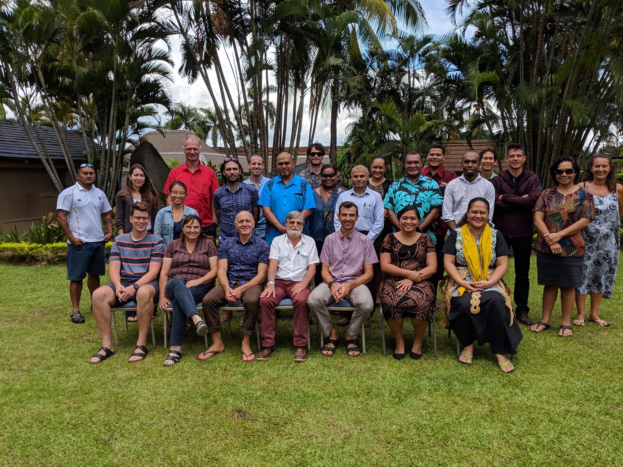
Key to the success of the process was the collaboration with stakeholders from the region throughout the process, including data holders, marine resource users, public and private sector environmental agencies, and relevant national, regional and international governance authorities. Following initial compilation and analyses of physical environmental data, expert workshops were held in both the Indian Ocean (Seychelles, South Africa) and SW Pacific (Fiji) to develop, refine and finalise the bioregions for these ocean areas. This helped to ensure that the work produced a set of appropriate, inclusive, integrated and transparent management tools for the region.


In a second phase, the biogeographic regionalisation for the Indian Ocean was used to develop a marine protected prioritisation tool for use in the area beyond national jurisdiction. Maps of predicted biodiversity patterns produced through new modelling techniques were combined with bioregional boundaries and the boundaries of areas already recognised for their biodiversity importance (EBSAs and VME closures), alongside the footprint of human use and other anthropogenic pressures (largely fisheries and proposed deep-sea mining sites). The approach ran through a series of conservation prioritisation scenarios that added more complexity to analyses for each new scenario, moving from a broad ‘biodiversity only’ scenario that included all pelagic and benthic species, to prioritisations specific to pelagic and benthic biodiversity. The result is a systematic analysis of priority areas for identifying key biodiversity areas in ABNJ in the Indian Ocean.

Above: Benthic biogeographic regionalisation developed for the Indian Ocean. Each biogeographic province is represented by a different colur, identified on the basis that each province contains distinct biodiversity. Image courtesy CSIRO.

Above: Prioritisation framework for identifying key areas for conservation within ABNJ in the Indian Ocean. This incorporates information on biodiversity for pelagic and benthic species, biogeographic regionalisation schemes for the Indian Ocean, areas recognised for their biodiversity significance (e.g., EBSAs & VME closures) and spatial footprints for existing pressures in ABNJ. Image courtesy CSIRO.
Impact and relevance
Biogeographic regionalisations produced by GOBI for the Indian Ocean and western South Pacific (and the data within) have found a wide range of applications in both regions. The reports and datasets have been used by competent authorities in fisheries ecosystem assessments and development of strategies for mapping Vulnerable Marine Ecosystems, as well as in the assessment of fisheries risk in relation to climate change. Governments in the regions have used the bioregionalisation outputs to aid marine spatial planning and management of biodiversity in national waters, with the 23 member States of the Indian Ocean Rim Association (IORA) formally endorsing the biogeography produced for the Indian Ocean. In area beyond national jurisdiction, the methodologies have been adopted by the International Seabed Authority to support the assessment of cumulative impacts from deep sea mining in the Regional Environmental Management Plan (REMP) for the Mid Atlantic Ridge, and the Indian Ocean bioregionalisation data have been used to support development of the draft Indian Ocean REMP.


Key publications from this work
Dunstan P et al. (2020) Bioregions of the South West Pacific Ocean. CSIRO, Australia. 143 pages. https://gobi.org/wp-content/ uploads/2021/03/Final-workshop-report-Pacific_v5_1-1.pdf
Dunstan P et al. (2020) Bioregions of the Indian Ocean. CSIRO, Australia. 213 pages. https://gobi.org/wp-content/uploads/2020/07/ Final-workshop-report-Indian_v4_1-1-1.pdf
Dunstan P et al. (2020) Bioregions of the South West Pacific Ocean and Indian Oceans. CSIRO, Australia. 23 pages.
Woolley S, Foster S, Bax N, Currie J, Dunn D, Hansen C, Hill N, O’Hara T, Ovaskainen O, Sayre R, Vanhatalo J, Dunstan P (2019) Bioregions in marine environments: Combining biological and environmental data for management and scientific understanding. BioScience 70; doi: 10.1093/ biosci/biz133


